- Home
- Ireland Sightseeing
- Detailed Maps of Ireland
Detailed Maps of Ireland:
Here is the Fastest, Funnest Way to Get to Know the Emerald Isle!
Ok fine, 'funnest' isn't an actual word but whatever... Here are our favorite detailed maps of Ireland, showing the home of the Blarney Stone, Lord
of the Dance, James Joyce, Leprechauns and Guinness Stout.
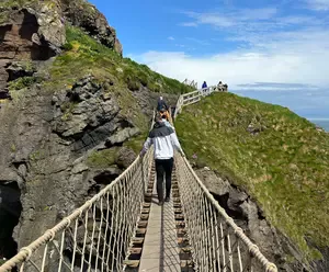
How Well Do You Know Your Irish Stuff?
 and famous landmarks.")
A basic understanding of Ireland's provinces, counties, cities and attractions can be a huge help in discovering your own Irish side!
So let's take a closer look these detailed Ireland maps. The first thing you will notice is the Emerald Isle is divided into four provinces (plus Northern Ireland).
Detailed Maps of Ireland: Connacht Province
It's on the western side of the island, and it is the smallest province on the detailed maps of Ireland.
The primary counties in the province include Galway and Sligo Counties, both of which also are home to the largest cities in the province.
The entire county only has a population of just over 540,000 people, but it is home to one of Ireland’s most amazing natural sites: the Killary Harbor, the one natural fjord in Ireland.
Connacht is home to the largest island on the Ireland map, Achill, and it is also home to Lough Corrib.
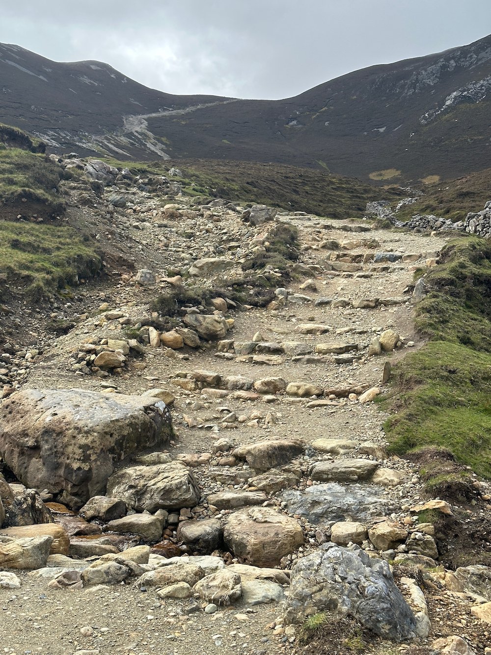
The western part of the country is very rugged and decidedly inhospitable to crops - and for the most part, people as well.
The upside to the rugged terrain is that it is incredibly picturesque, with some of the most popular mountains in the country.
The Connemara National Park are at home in this province, as are the Aran Islands with their ancient forts.
These forts, such as the Dun Aonghasa, are one of the most popular tourist destinations in Ireland.
The city of Galway is found in Connacht Province, and its population of over 75,000 makes it the largest city in the county.
The city began as a fort built in the 1100s, and has expanded into one of the largest cities in Ireland.
Connacht has had many battles fought over its territory, such as The Battle of Claenloch in 538 and the Battle of Cuil Conaire in 550.
The Vikings raided and inhabited Connacht for many years, and Galway was the location of the Siege of Galway during the Williamite War.
The Battle of Aughrim also took place in Connacht in 1691.
Detailed Maps of Ireland: Leinster Province
This area is found on the eastern side of the detailed maps of Ireland, and this province has over 2 million inhabitants.
The capital of the country, Dublin, is located in Leinster, along with some of the primary counties like Kildare, Kilkenny, and Carlow.
The county was actually divided into two at one time - Leinster and Pale - but become one after the Norman Invasion of Ireland.
The weather of Leinster is fairly pleasant for much of the year, and the main city of Dublin actually gets less rainfall than the rest of the country.
The climate of Dublin maritime without extreme temperatures, and the entire county is usually subjected to mild climates without temperature extremes.
In certain parts of the province, notably Kilkenny, the primary language is English, with Irish being the language spoken most commonly after English.
The metropolitan area of Dublin is home to over 1.8 million people. Most of the other counties and cities on the Ireland map have a fairly small pollution when compared to the capital city.
Dublin began as a Viking settlement, and it was controlled by the British until the Normans invaded Ireland. The province was actually a good deal smaller historically than it is today.
The the kingdom was first formed by Ugaine Mor (Hugony the Great), who united the tribes of Leinster.
Drogheda was an important part of the War of the Roses, and it is the place where the Earl of Worcester ordered the Earl of Desmond executed along with his two sons.

Detailed Maps of Ireland: Munster Province
This Province is in the south of the detailed maps of Ireland, and it covers nearly 25 thousand square meters with a population of over 1.2 million people.
Its primary counties include Cork, Limerick, and Waterford, with Cork being the most populated city in the province.
Munster was once home to the Iverni tribes, including Clanna Dedad. The county was divided into three kingdoms, hence the three crowns on the flag of Munster.
Daniel O’Connell and Michael Collins both hail from Munster, and this area is incredibly famous for its Irish music.
Munster is also famous for its sports, and it is the place where hurling and other Gaelic games were created.
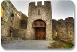
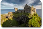
The region is also home to a number of monasteries and castles, making it one of the most popular tourist destinations on the Island.
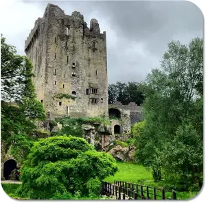
The Blarney Stone is at home in Munster Province, in the Blarney Castle a few miles from the city of Cork.
Cork County is called by outsiders the Rebel County of Ireland, while the residents of Cork call it the real capital of Ireland.
The book Angela’s Ashes by Frank McCourt was written about the city of Limerick, and bands like The Cranberries and The Hitchers come from this county.
The climate of the region is colder than much of the country, with a very high average yearly rainfall. Cork is one of the colder cities, with Limerick’s climate being much more temperate.
Cork is famous for its fog, while Limerick is famous for its amazing clouds. It has only 1,273 hours of sunshine per year, and up to 62 days on average without any sun.
Detailed Maps of Ireland: Ulster Province
Last but not least, Ulster Province occupies the northern part of the detailed maps of Ireland, and this is where the independent state known as Northern Ireland is located.
The capital city of Belfast is located here, along with other primary cities like Derry and Bangor.
The main counties are Antrim, where Belfast is located, Down, and Londonderry. The population of Ulster is just over 2 million.
Ulster was once ruled by powerful Irish clans, and they were the only province in Ireland that was not under British control by the end of the 14th century.
Ulster only fell to the English forces in the Nine Years War in the 1600s, and they held their position as the last bastion of Gaelic culture in Ireland until that time.
The climate of Ulster is fairly temperate, as is the rest of the island. The temperature stays fairly constant, though the rainfall is fairly high and the conditions are generally windy.
Bangor, one of the primary cities in Ulster, was once home to a number of monasteries, and it was considered a place of prayer, learning, and religion.
Derry played a major role in the Irish Rebellion in 1641. General Eisenhower visited Bangor during World War II to address the troops leaving to participate in the landings that came to be known as D-Day.
Want More Irish Landmarks?
Taking a virtual tour of beautiful Irish landmarks is one of our favorite ways to enjoy an Irish experience, wherever in the world we happen to be!
The popularity of Irish sights is the reason why one of our most popular ebooks is called "Favorite Sights to See in Ireland."
That book is just one chapter in a downloadable, share-able collection of Irish games, puzzles, recipes, songbooks, quizzes, travel guides and more - that we have collected for you over the years.
Want them right now? Keep reading to learn about "Your Irish Expressions Playbook."
Everybody Has an Irish Side...
More Fun With Irish Expressions:
Your Irish Expressions Playbook
Congratulations on learning more about what we like to call your "Irish Side." You may be thinking "I'd love to actually VISIT Ireland but that's really not in the cards right now. What am I supposed to actually DO with the stuff I just learned?"
Well never fear! Since 2007 we have collected all of the best printable, shareable resources we could find, to help you put your new knowledge of Ireland to good use. We've put them all together on one page we call "Your Irish Expressions Playbook"
 |
GAMES | PUZZLES | RECIPES | MORE ... more downloads added daily! |
Think games ... puzzles ... recipes ... song lyrics ... Access them ALL for one small price. Print as often as you like and share them with your friends - with no limitations! Once you're in, you are in - forever.
But order soon - we are always adding to the IE Playbook and this price will not last long.
PRO TIP: Once you have checked out, you should be routed to your Playbook within 7 seconds. Or click the 'return to merchant' button to get there faster. Then bookmark the page, so you can return whenever you like.
Any issues? Just reach out to us at support@irish-expressions.com and we will make it right.
Please Share Your Feedback
Did we miss anything? Is there a topic you would like us to cover in the future? Tap HERE to let us know!
ENJOYING IRISH EXPRESSIONS? PLEASE SHARE US WITH OTHERS!
Recent Articles
-
How to Write a Limerick: An Easy, Fun Way to Show Your Irish Side!
Mar 12, 26 09:22 AM
 Learning how to write a limerick is one of the easiest and most entertaining ways to express your Irish Side. Read on for simple, easy to learn instructions!
 -
This Week in Ireland - St Patrick's Festival
Mar 08, 26 06:01 PM
Dublin is leaning fully into St. Patrick’s Festival this week, with the official 2026 programme running from March 14 through March 17 and filling the city centre with performances, family events, wor…
-
Irish Expressions and Activities: Share Your Irish Side!
Mar 03, 26 07:17 PM
 Use Irish expressions and activities such as sayings, songs, symbols, sights, flavors, and fun to share your personal Irish side, wherever you are in the world!
 -
This Week in Ireland - Irish Language Festival
Mar 01, 26 04:07 PM
Across Ireland this week, a quiet cultural rhythm is rising: the annual celebration of Seachtain na Gaeilge has begun. Starting on March 1st and continuing toward St. Patrick’s Day, this is the larges…
-
This Week in Ireland - Birthday of George Bernard Shaw
Feb 16, 26 01:13 PM
This week in Ireland marks the February 18 birthday of George Bernard Shaw, born in Dublin in 1856. Shaw remains one of Ireland’s most influential literary figures — a Nobel Prize-winning playwright w…
-
This Week in Ireland - Remembering Sean Treacy
Feb 08, 26 12:25 PM
This week in Ireland marks the anniversary of the birth of Seán Treacy, born on February 14, 1895 in County Tipperary — a date that continues to resonate in the story of Ireland’s revolutionary period…
-
This Week in Ireland - Ireland's Newest Public Holiday
Feb 02, 26 12:33 AM
This week in Ireland opens with the country’s newest public holiday in active use, as St Brigid’s Day sets the tone for early February. What was once a quiet cultural marker is now being lived in real…
-
This Week in Ireland - St Brigid's Eve
Jan 26, 26 09:45 AM
This coming week in Ireland culminates with St Brigid’s Eve on January 31, marking the quiet transition between winter and spring. Historically, St Brigid’s Eve is a time for small household rituals r…
-
This Week in Ireland - Approaching St Brigid's Day
Jan 19, 26 04:55 PM
This coming week in Ireland sits at a quiet threshold — the final full stretch before the arrival of St Brigid’s season and the ancient festival of Imbolc. While winter still holds the land, the cultu…
-
Ireland Culture and Customs: Simple Ways to Express Your Irish Side!
Jan 12, 26 09:47 AM
 Learn what makes Ireland culture and customs so fascinating to so many people! Read on to build the culture of Ireland into your day to day Irish expressions!
 -
Cong Village Things to Know
Jan 11, 26 07:10 PM
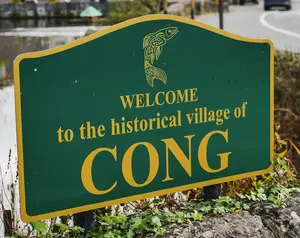 Cong Village things to know starts with this: Don't miss it! A lovely Irish town and a wonderful stop on any Irish tour (virtual or otherwise :-).
 -
This Week in Ireland - St Ita's Feast
Jan 11, 26 06:33 PM
St Ita holds a distinctive place in Ireland’s spiritual story — one that feels especially fitting for the quieter stretch of mid-January.
Saint Ita lived in the sixth century, during the formative year…
-
Famous Irish Landmarks: Beyond the Castles
Jan 11, 26 05:17 PM
 There are many famous Irish landmarks that have nothing to do with castles! From quaint villages to majestic landscapes, we share our list of favorites.
 -
Your Irish ID: Share Your Irish Side!
Jan 07, 26 12:04 AM
 Here is where you generate your customized "Irish ID" and use it to proudly share your Irish Side with others!
 -
Irish Christmas Traditions: A Global Celebration with an Irish Twist!
Jan 05, 26 04:01 AM
 Learn wonderful Irish Christmas traditions and customs! This section will help you express your Irish side during the most joyful time of the year.
 -
Adare Castle Things to Know: Fun Facts About An Amazing Irish Landmark
Jan 05, 26 03:59 AM
 Explore Adare Castle things to know: A standing monument to times past, and a wonderful Irish experience to enjoy - with or without traveling to Ireland.
 -
This Week in Ireland - Return to the Pilgrimage Mindset
Jan 04, 26 09:04 PM
 The days immediately after Little Christmas mark a subtle shift in Ireland’s rhythm. Decorations come down, holiday visitors thin out, and the country settles into a quieter, more inward-looking se…
 -
This Week in Ireland - Preparing for Little Christmas
Dec 28, 25 05:24 PM
 As December draws to a close, Ireland reaches the quiet ending of the traditional 12 Days of Christmas. Year-end rituals such as St Stephens Day take center stage, foretelling the arrival of Little…
 -
This Week in Ireland - The 12 Days of Christmas
Dec 20, 25 01:58 PM
 In much of the modern world, Christmas feels like it arrives all at once — and disappears just as quickly. Decorations go up, gifts are exchanged, and by December 26 the season is already winding d…
 -
Newgrange Things to Know: Key Facts About an Incredible Irish Monument
Dec 14, 25 01:37 PM
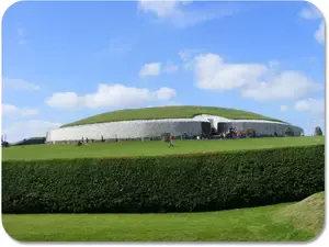 Looking for Newgrange things to know? You're in the right place. Older than the pyramids in Egypt, this ancient monument is a historical and scientific marvel.
 -
This Week in Ireland - Winter Solstice and Newgrange
Dec 14, 25 01:13 PM
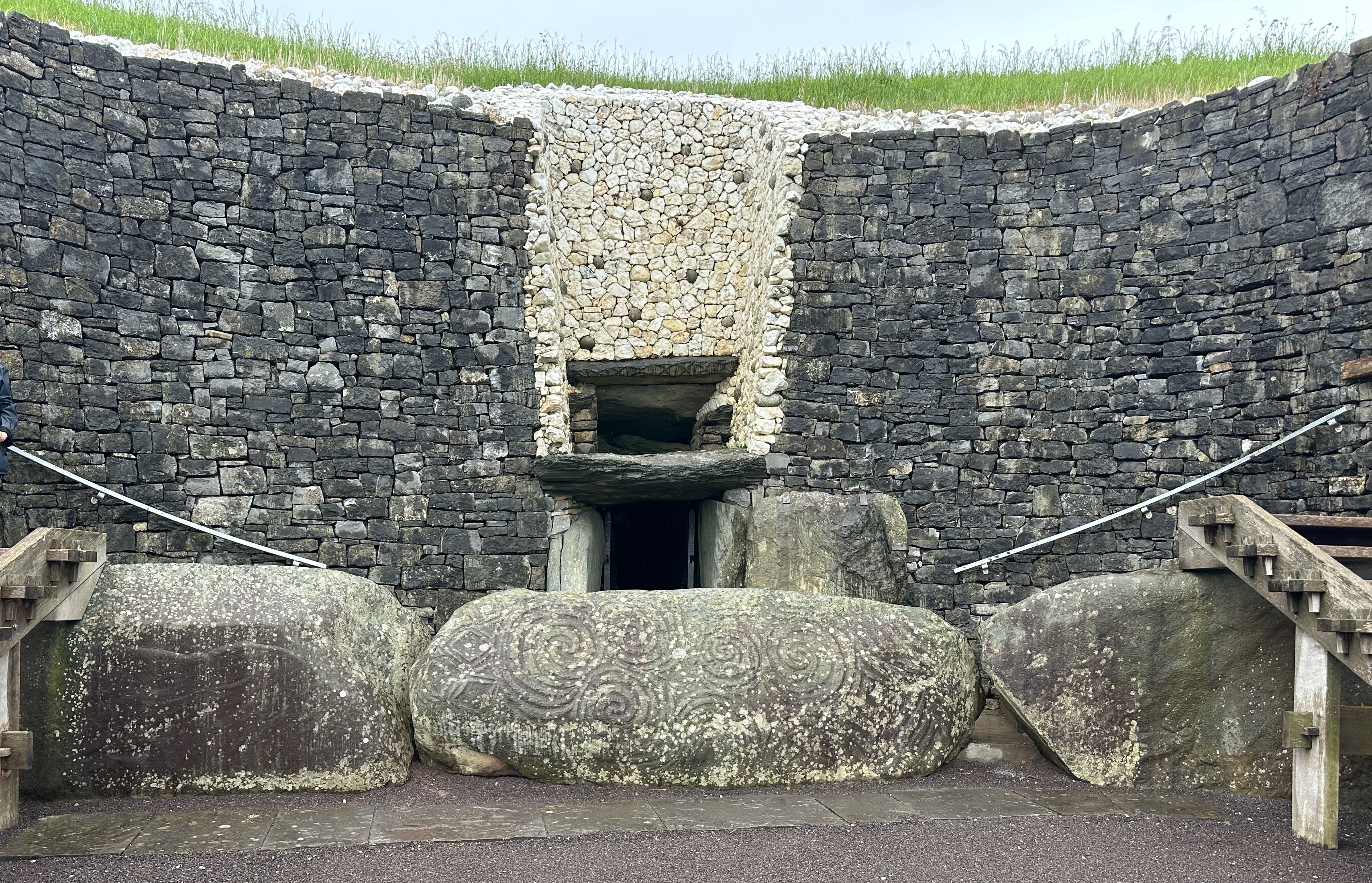 Ireland reaches one of its most quietly powerful moments this coming week: the winter solstice. On December 21, the shortest day of the year marks an annual celestial turning point. Long before mod…
 -
Dunluce Castle Things to Know: An Example of Ireland's Magical Past
Dec 12, 25 09:28 AM
 Dunluce Castle things to know: If it looks familiar to you, it probably is! Featured on album covers and hit movies, it is a very recognizable Irish Castle!
 -
Use Meaningful Irish Symbols to Express Your Irish Side!
Dec 02, 25 07:35 PM
 Irish Symbols are everywhere. Read on to see the Celtic Knot, Celtic Cross, Claddagh, Harp, Shamrock, the Tree of Life, the Triskelion and more!
 -
Irish Song Lyrics: Sing Along to 10 Favorite Irish Songs
Dec 02, 25 07:32 PM
 Here are Irish song lyrics to 10 of the most iconic Irish folk songs. Learn the lyrics, see our favorite performances and sing along to express your Irish side!
 -
Famous Irish Sayings: Proverbs, Blessings, Quotes and More!
Dec 02, 25 07:28 PM
 Here you will find 7 types of famous Irish sayings, including Irish proverbs, Irish blessings, Irish jokes, Irish limericks and Irish slang.
 -
Irish History for Beginners: A Fun Way to Connect to Your Irish Side!
Dec 01, 25 08:59 AM
 Here is a brief and fun overview of Irish history for beginners - where all Irish expressions began! Not your average history lesson!
 -
St Patricks Day Party Ideas: Share Your Irish Side!
Nov 18, 25 03:30 PM
 Finding the perfect St Patricks Day party ideas is the key to celebrating the most famous Irish holiday of all!
 -
St Patricks Day Craft Ideas: Simple Ideas to Adorn St Paddy's Day!
Nov 18, 25 03:26 PM
 St Patricks Day craft ideas give you a personal, colorful way to express your Irish side on St Patricks Day. Here are instructions for a few of our favorites!
 -
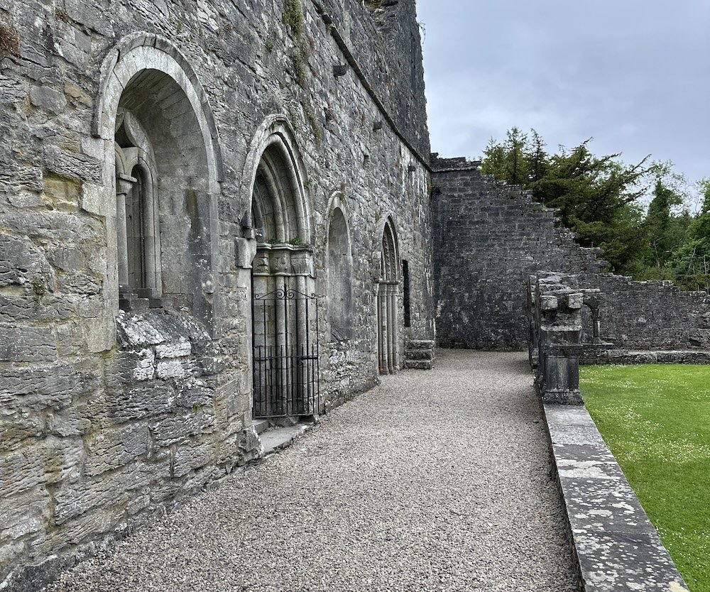
Jerpoint Abbey Things to Know: Key Facts About a Historic Irish Site
Nov 18, 25 03:24 PM
 Our Jerpoint Abbey things to know will enrich your visit to this lovely Irish landmark. Read on and enjoy a virtual tour!
 -
25 Irish Words and Phrases to Show Off Your Irish Side!
Nov 18, 25 03:22 PM
 Here are few Irish words and phrases and a bit 'o slang to help you express your Irish side, wherever you are in the world!
 -
Irish Dessert Recipes: Easy Treats With Irish Flavors
Nov 18, 25 03:04 PM
 Learn the most popular Irish dessert recipes, some the tastiest of all Irish expressions!
 -
Irish Birthday Traditions: Celebrating That Birthday Lad or Lass!
Nov 18, 25 02:57 PM
 Knowing a few Irish birthday traditions can take your Irish side to a whole new level. Read on to energize your next Irish birthday celebration!
 -
Irish Baby Gift Ideas: Never Too Young to Share Your Irish Side!
Nov 18, 25 02:54 PM
 Sharing Irish baby gift ideas is a time-tested method of expressing your Irish side! Read on to find exciting gift ideas with an Irish theme.